


Geography
How to work with digital stories in geography ?
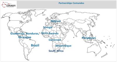 The aim of this chapter is to teach students geography by showing them digital stories from different countries and continents (Brazil, Honduras, Benin, …) and specific areas or communities.
Once they watch a video they answer some questions and, in order to answer them, they need to learn to use tools that are helpful (e.g. Google Maps, Google Earth, Ventusky) to get specific information about places.
With this chapter we want to promote learning by using online media tools, group work, and doing active research.
Comundos offers a brief course about the use of Google Earth and Google Maps. See annex.
Objectives:
- To make students know to use online tools related to geography and maps.To put into practice the theory taught.
- To teach the specific vocabulary of geography.
- To promote individual and group learning.
Questions and tasks (students will also answer the general questions shown above):
- From which continent and country on the map is this story told?
- What is the kind of climate in that region? (temperate, polar, dry, cold, tropical?)
- What is the dimension of this region? And the population density? – Explain how you got this information and which tool you used. (Students can use other tools to get information such as Google Search)
- Describe the geographic region using Google Maps or Google Earth, mentioning its latitude, longitude, body of water (oceans, seas, lakes…), vegetation, and explain if it is a mountainous or flat area. (e.g. This region is in contact with the Atlantic Ocean, there are high mountains…)
- What is the local climate now in the region of the story? (temperature, precipitation, wind speed…) Students can use the following link to get that information: Ventusky
- How has this region changed over the years? – Students can use Google Earth Pro to know that.
*Google Earth Pro has more tools and students can learn more characteristics of a region. This version needs to be downloaded (it is free).
By watching the following video…
- What is the biggest continent in the world? And the smallest one?
- What is the relation between population density and land area in every continent? What do you think about that? Is it positive, negative? Does it matter?
- What is the GDP? What information does it provide us?
→ Videos that could be used:
- Water Crisis in South Africa
- Mans Interaction with Nature. Our Environment (Cameroon)
- Loss of land and culture (Guatemala)
*Teachers can find more digital stories from other countries (Mozambique, Benin, Senegal…) at comundos.org
→ Extra activity – Let’s play with Google Earth
Google Earth has a button where it says: I’m Feeling Lucky. Students will click on that button and they will travel across their screen to a specific place (e.g. Toucountouna in Benin). Learners will be asked to do a little research on that place and will have to describe it (perimeter, area, distance), briefly explain some features of the region where that place is located, give information about people and their culture, etc.). This little research will be shown and explained to colleagues. For example, they can present this by making a PowerPoint.
A gift for Comundos
 Over the years, Comundos has helped remote communities around the world by teaching critical thinking, media literacy and the use of communication technology.
To do this effectively, we need your support for computers, translations, courses and social media management.
Thank you .
BE11 1030 2973 8248